The most important rule when using a hurricane tracker is simple: treat the tracker as a decision-support tool, not as a single line showing exactly where a storm will go. Start with the latest official advisory, check whether your location is under a watch or warning, then use the forecast cone, wind probabilities, arrival-time graphics, rainfall information, and local emergency instructions together.
That order matters because a tropical cyclone is much larger than its center point. Dangerous wind, storm surge, heavy rain, tornadoes, surf, and rip currents can occur far from the line drawn through the middle of a forecast cone. A tracker is most useful when you know which layer answers which question.
For U.S. users, the primary source should be the National Hurricane Center for Atlantic, eastern Pacific, and central Pacific tropical cyclones, combined with your local National Weather Service office and instructions from local emergency-management officials.
What You Need Before You Start Tracking a Storm
You do not need meteorology training to use a hurricane tracker well. You do need three pieces of information: your exact location, the name or identification number of the system you are following, and the time of the latest advisory.
A tropical cyclone advisory is an official update describing a storm's position, movement, intensity, forecast, and hazards. When the National Hurricane Center is issuing regular advisories for an active tropical cyclone, its standard advisory packages are generally issued every six hours. Intermediate advisories may also appear when conditions require more frequent updates.
Do not assume the map on a search page or social-media post is current. Always look for the advisory time. A map that is six or twelve hours old can be materially different from the newest forecast.
As a real example of why timestamps matter, the NHC's 2:00 a.m. EDT Tropical Weather Outlook on October 6, 2026 reported that disturbance AL92 in the southwestern Gulf had an 80% chance of tropical cyclone formation within both 48 hours and seven days. At that time, it was still a disturbance rather than an Atlantic tropical cyclone with a normal storm advisory package. The same morning, NHC was separately issuing advisories for Hurricane Rachel in the eastern Pacific. Those conditions can change, so this example should not be used as a current forecast; it demonstrates why you must identify the basin, system, and update time before interpreting a tracker.
Step 1: Open the Official Storm Page First
Begin at the NHC home page and select the relevant basin: Atlantic, Eastern North Pacific, or Central North Pacific. If a named storm, tropical depression, or potential tropical cyclone is active, open its storm page. If no cyclone has formed yet, use the Tropical Weather Outlook, which shows areas being monitored for possible development.
This distinction is important. A disturbance shown on a seven-day outlook does not yet have the same forecast products as a named tropical cyclone. If you see a development percentage such as 40% or 80%, that percentage refers to the chance that a tropical cyclone will form during the stated period. It is not the probability that the system will hit your city.
Step 2: Read the Latest Public Advisory Before Studying the Map
The Public Advisory is the fastest way to understand what the storm is doing now. Look for the current center location, maximum sustained wind, direction and speed of movement, minimum central pressure, watches and warnings, and the main hazards affecting land.
For example, the NHC Public Advisory for Hurricane Rachel at 2:00 a.m. PDT on October 6, 2026 placed the center at 20.3°N, 118.6°W, moving west at 8 mph, with maximum sustained winds of 85 mph. The advisory also stated that there were no coastal watches or warnings in effect at that time, while dangerous surf and rip currents could still affect parts of Baja California and southern California.
That example shows why looking only at a category number is a mistake. A storm can be far offshore and still create hazardous surf. Another storm may be weaker by wind speed but produce major flooding or surge.
Step 3: Use the Forecast Cone Correctly
The forecast cone represents uncertainty in the future track of the storm's center. It does not show the full size of the storm, and it does not mean locations outside the cone are safe.
According to the NHC's official definition of the track forecast cone, the operational cone is based on historical forecast errors. For 2026, its circles are sized so that roughly two-thirds of historical official track errors from the previous five years fall within them at each forecast period.
Use the cone to answer: Where could the storm center plausibly travel? Do not use it to answer: Will my house experience dangerous weather? For that, you need hazard-specific products.
A practical example
If your town lies just outside the cone but is on the storm's stronger side, tropical-storm-force winds or storm surge could still reach you. Conversely, a location inside the cone is not guaranteed to experience the storm center. The cone is a track-uncertainty graphic, not an impact boundary.
Step 4: Check Watches and Warnings Next
A watch means hazardous conditions are possible. A warning means those conditions are expected. For hurricanes, the National Weather Service defines a Hurricane Watch as hurricane-force conditions being possible, generally with about 48 hours of lead time before the expected onset of tropical-storm-force winds. A Hurricane Warning means hurricane conditions are expected, generally within 36 hours.
The same concept applies to tropical storm and storm surge watches and warnings. You can review the official definitions on the National Weather Service watch and warning definitions page.
When a warning is issued for your area, do not wait for the center line to move closer before acting. Follow local evacuation and shelter instructions. Local authorities make decisions using more than the storm track alone, including expected surge, flood vulnerability, road access, and the time required to move people safely.
Step 5: Read Wind Speed Probabilities Instead of Guessing From the Track
A useful tracker should provide wind probability information. NHC publishes probabilities for sustained winds reaching tropical-storm force, 50 knots, and hurricane force at selected locations and across maps.
These probabilities are more useful than asking whether your city is exactly under the center line because they account for uncertainty in track, storm size, and intensity. If your location has a meaningful probability of tropical-storm-force winds, you should think about when outdoor preparations need to be complete, not just where landfall is forecast.
Remember that wind probability is still not a complete hazard forecast. Heavy rainfall, freshwater flooding, storm surge, tornadoes, and dangerous surf require separate information.
Step 6: Use the Arrival-Time Graphic to Decide When Preparations Must End
The arrival-time graphic estimates when sustained tropical-storm-force winds could begin. This matters because once those winds arrive, tasks such as installing shutters, moving outdoor furniture, traveling long distances, or evacuating may become unsafe.
NHC provides an Earliest Reasonable Arrival Time and a Most Likely Arrival Time. The NHC arrival-time guidance explains that the earliest reasonable time is designed for users with a low tolerance for risk. It identifies the time before which there is no more than a 10% chance that sustained tropical-storm-force winds will have begun.
For household preparation, the earliest reasonable arrival time is usually the safer planning marker. If the map suggests tropical-storm-force winds could arrive Thursday evening, do not schedule the last essential preparation for Thursday evening. Build in extra time for traffic, store closures, power interruptions, and forecast changes.
Step 7: Add Local Rainfall, Flood, Surge, and Tornado Information
A hurricane tracker is incomplete if you only watch wind and track. Open your local National Weather Service forecast and hazard page to check rainfall totals, flash flood watches or warnings, coastal flood information, tornado threats, and local timing.
If you live near the coast, pay particular attention to storm surge products. Storm surge is the abnormal rise of seawater above the normal astronomical tide caused by a storm. A storm does not need to make landfall directly over your community to produce dangerous coastal inundation.
If you live inland, do not assume you are outside the main danger zone. Tropical systems can produce destructive flooding hundreds of miles from the coast. Your local NWS office is often more useful than a national storm map for neighborhood-level rainfall and flood hazards.
Step 8: Turn On More Than One Warning Channel
A tracker should never be your only alert system. Internet service and power can fail during a storm, and a website is useful only if you remember to check it.
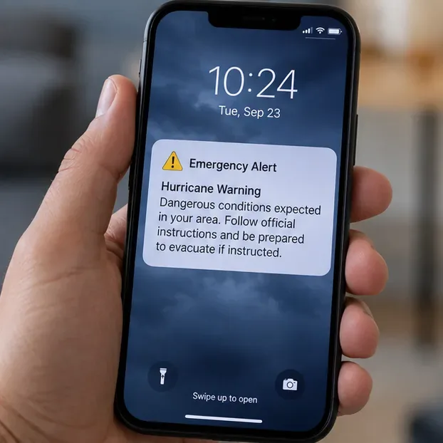
The National Weather Service recommends multiple ways to receive warnings. Wireless Emergency Alerts (WEA) are government emergency messages delivered through participating mobile carriers to compatible phones in an affected area. NOAA Weather Radio is another option and broadcasts official watches, warnings, forecasts, and hazard information continuously. The NWS warning dissemination page explains both systems.
Keep emergency alerts enabled on your phone. If you live in a hurricane-prone area, a battery-powered or hand-crank NOAA Weather Radio can provide an additional source when internet access is unreliable.
What to Look at First When You Only Have Two Minutes
| Question | Tracker layer or source | What it tells you |
|---|
| What is happening right now? | Latest Public Advisory | Current position, intensity, motion, and immediate hazards |
| Could the center move toward me? | Forecast cone | Track uncertainty for the storm center |
| Is official action being requested? | Watches, warnings, and local authorities | Whether dangerous conditions are possible or expected |
| How likely are damaging winds? | Wind speed probabilities | Probability of reaching specific sustained-wind thresholds |
| When should preparation be finished? | Earliest reasonable arrival of tropical-storm-force winds | A conservative preparation deadline |
| What could happen at my location? | Local NWS forecast and hazard products | Rain, flooding, surge, tornado, wind, and local timing details |
Common Hurricane Tracker Mistakes to Avoid
Mistake 1: Following the center line as if it were a road
The center line is a forecast, not a guaranteed path. Focus on the full cone and hazard maps.
Mistake 2: Assuming the cone shows storm size
It does not. Winds and other hazards may extend far outside the cone.
Mistake 3: Treating a development percentage as a landfall probability
A Tropical Weather Outlook formation percentage estimates the chance that a disturbance becomes a tropical cyclone. It does not tell you the probability of impact at a specific city.
Mistake 4: Watching category changes but ignoring water
The Saffir-Simpson category is based on maximum sustained wind. It does not directly describe rainfall flooding, storm surge, or tornado risk.
Mistake 5: Using an old screenshot
Forecasts evolve. Always verify the advisory number and timestamp on the official storm page.
Mistake 6: Waiting for a warning before making every preparation
Some preparations take longer than the warning lead time. Use watches, arrival-time guidance, and local emergency plans to act early enough.
How Often Should You Refresh a Hurricane Tracker?
For an active tropical cyclone, checking around official advisory times is more useful than refreshing every few minutes. NHC's routine tropical cyclone advisory packages are generally issued every six hours, while intermediate advisories can be issued when needed. Watches, warnings, local evacuation orders, and severe-weather alerts can change between those routine cycles, so keep automatic alerts enabled.
If a storm is still only a disturbance, monitor the Tropical Weather Outlook and any NHC key messages. Once advisories begin for a tropical depression, tropical storm, hurricane, or potential tropical cyclone, switch to the storm-specific page.
Final Check: Are You Using the Tracker Safely?
Before you close the map, verify five things: you are looking at the newest advisory; you know whether your area is under a watch or warning; you understand that the cone shows center-track uncertainty rather than total impact; you have checked the earliest reasonable arrival time of tropical-storm-force winds; and you have reviewed local NWS and emergency-management instructions.
If all five are covered, the hurricane tracker is doing its job: helping you turn a changing forecast into timely decisions. If an official evacuation order or emergency warning conflicts with what a general-purpose weather app seems to show, follow the official local instruction. The safest tracker is not the one with the most animated layers; it is the one that gets you to authoritative information quickly and helps you act before hazardous conditions arrive.