Home
» Today
»
Macquarie Island Shutdown Slows Earthquake Detection by Two Minutes — November 22, 2026
Macquarie Island Shutdown Slows Earthquake Detection by Two Minutes — November 22, 2026
Information checked: November 22, 2026, 1:25 a.m. UTC (November 22, 2026, 12:25 p.m. Australian Eastern Daylight Time, AEDT, UTC+11:00).
Australia’s decision to temporarily hibernate its remote Macquarie Island research station has interrupted a critical stream of seismic data from the Southern Ocean. Government correspondence reported on November 22 indicates that earthquake detection near the island is estimated to take about 10 minutes rather than eight while the observatory is offline. That two-minute loss reduces the time available to assess a possible tsunami threat to Australia’s southeastern coastline, although Geoscience Australia says its alerting process is still expected to meet required timelines.
The observatory lost power after the Australian Antarctic Division (AAD) withdrew expeditioners in October amid concern about a possible H5 avian influenza outbreak affecting the island’s wildlife. The new warning-time assessment concerns the speed and sensitivity of earthquake detection; it is not evidence that a tsunami is approaching or that all Australian warning services have stopped.
Destaques
Macquarie Island’s seismic observatory is offline after the October 2026 station withdrawal.
Estimated regional earthquake detection has slowed from around eight to 10 minutes, according to government information reported November 22.
Australia’s Joint Australian Tsunami Warning Centre remains operational, with other domestic and international seismic stations providing data.
Officials aim to restore automated monitoring with solar power in 2027, but no confirmed restart date has been announced.
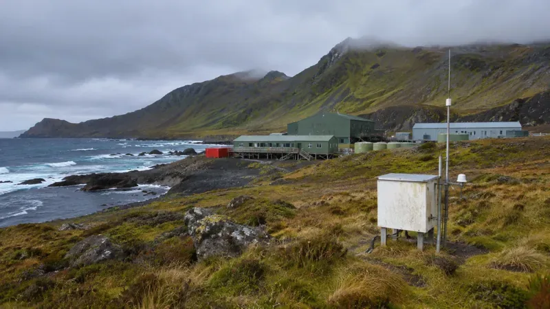
Photorealistic illustration of a remote subantarctic research station and monitoring equipment; not a documentary photograph of Macquarie Island or its actual seismic observatory.
Why has the Macquarie Island seismic station stopped transmitting?
The AAD confirmed on November 16 that expeditioners had been temporarily withdrawn and the station placed in hibernation in October because of the risks associated with a possible H5 bird flu outbreak. The initial August 28 withdrawal announcement cited potential psychosocial harm to staff if a large-scale wildlife mortality event occurred. It did not state that a human outbreak had been confirmed on the island. The station sits in a wildlife-rich area near elephant seal breeding grounds, making extended operations unusually sensitive to a potential animal disease emergency.
Unlike an ordinary mainland monitoring site with ready access to technicians and utility power, Macquarie Island depends on complex support arrangements across a remote marine environment. Staff departure and loss of station power meant Geoscience Australia’s seismograph could no longer provide its usual real-time observations. Some other remote surveillance and weather-related equipment was installed before withdrawal, according to the AAD, but those systems should not be confused with restoration of the seismic observatory.
Why does losing one island sensor slow earthquake detection?
Macquarie Island lies roughly 1,500 kilometers southeast of Tasmania, close to the boundary between the Australian and Pacific tectonic plates. An instrument near a possible earthquake source gives analysts early, geographically valuable measurements of ground shaking. When it goes silent, automated systems must rely more heavily on measurements from farther away. Signals need time to travel through the Earth, and a smaller number of nearby observations can make it harder to locate and size an earthquake promptly.
That is why the effect is not simply one less device on a long list. According to the newly reported correspondence, the loss of real-time observations reduces both regional coverage and the sensitivity of earthquake detection. The estimated shift from eight to 10 minutes is a modeling-based comparison for earthquakes in this region, not a stopwatch measurement demonstrating that every future alert will be delayed by exactly two minutes.
Geoscience Australia’s National Earthquake Alerts Centre uses real-time information from more than 100 Australian monitoring locations and hundreds of international stations. This wider network remains in service. Its existence provides redundancy, but geographically unique stations can still matter disproportionately to a particular tectonic boundary.
How do earthquake detections become Australian tsunami warnings?
An earthquake is not itself a tsunami warning. First, seismologists determine when and where the earthquake occurred and estimate its magnitude and depth. Then the Joint Australian Tsunami Warning Centre (JATWC), jointly operated by Geoscience Australia and the Bureau of Meteorology, evaluates whether the event might produce dangerous ocean conditions. Sea-level instruments, tide gauges and tsunami detection buoys help verify and refine the threat assessment.
Under the published JATWC operating framework, Geoscience Australia aims to send critical earthquake information to the Bureau of Meteorology within 10 minutes of an event. The Bureau then assesses potential impacts and issues relevant tsunami bulletins and warnings. Geoscience Australia told the ABC that, despite slower and less sensitive detection south of Australia and New Zealand, alerts are still expected within the required timeframe. The public should therefore distinguish a reduced time cushion in the early detection step from a confirmed breakdown of the broader warning chain.
Warning categories also matter. A marine threat may mean hazardous currents and conditions along the shore without expected widespread inundation; a land threat indicates possible flooding of low-lying coastal areas. Whether and where a warning is issued depends on the specific earthquake and tsunami modeling—not just on whether a single seismograph is operating.
Does the two-minute delay put Tasmania and southeast Australia at greater risk?
The concern is mainly about response time. If a powerful undersea earthquake occurred in a relevant part of the Southern Ocean, a slower first assessment could leave emergency managers with less time to evaluate hazards and communicate protective action. It does not follow that a tsunami is imminent, or that two minutes automatically translates into an identical delay in every public warning. Travel time to the coast varies with the earthquake’s location, ocean depth and the geography of the affected shoreline.
For people near the coast, the practical message has not changed: consult the Bureau of Meteorology’s official tsunami warnings and follow state and territory emergency-service instructions. If there are natural warning signs such as a strong or long earthquake, unusual sea behavior or a sudden roaring sound from the ocean, move away from the shore and toward higher ground or inland without waiting for an official alert.
When could the Macquarie Island seismic observatory operate again?
Geoscience Australia says it attempted to automate the station during the October drawdown, but strong winds made installation of the necessary rooftop solar panels unsafe. The agency is working with the AAD on a return to the island in early 2027 to finish the power-and-automation work. That is a plan, not a confirmed commissioning date; safe access, weather and successful equipment installation remain conditions for restoration.
Separately, the AAD announced on November 16 that the research and supply vessel RSV Nuyina is planned to visit in March 2027 to remove approximately 185,000 liters of diesel from the island’s fuel farm. The fuel retrieval is an environmental-risk measure and should not be mistaken for a firm timetable for restarting seismic transmissions or permanently reopening the research station.
Macquarie Island illustrates a broader resilience challenge: a remote monitoring network can be internationally connected yet still depend on local power, maintenance access and people. Restoring independently powered instruments could recover a valuable observation point without requiring immediate year-round staffing. Until officials confirm that live data has resumed, the best-supported description is that the observatory remains offline and the wider warning network continues operating.
Frequently asked questions
How much slower are earthquake alerts without Macquarie Island?
Regional earthquake detection is estimated to take about 10 minutes instead of eight while the island observatory is offline. This is not a guaranteed two-minute delay for every public tsunami warning.
Has Australia stopped issuing tsunami warnings?
No. The Joint Australian Tsunami Warning Centre is still operational, using data from many Australian and international monitoring sites.
Why was the station closed, and when will it reopen?
Personnel were withdrawn in October 2026 because of risks linked to a possible H5 avian influenza wildlife outbreak. Officials hope to restore automated seismic monitoring in 2027, but have not confirmed a restart date.