Home
» Today
»
El Niño Explained: Why a Strengthening Pacific Pattern Matters for Global Weather | Nov. 16, 2026
El Niño Explained: Why a Strengthening Pacific Pattern Matters for Global Weather | Nov. 16, 2026
Information checked: November 16, 2026, 4:05 p.m. Bangkok time (ICT, UTC+07:00); November 16, 2026, 09:05 UTC.
El Niño is already reshaping the tropical Pacific in late 2026, and its influence may extend to storm tracks, drought risks, and winter temperatures far from the ocean where it begins. In its November 12 advisory, the U.S. National Oceanic and Atmospheric Administration (NOAA) said El Niño was strengthening and assigned a greater than 79% probability to strong-to-very-strong conditions during January–March 2027. That outlook raises the odds of familiar El Niño weather patterns, but it does not mean that any particular city is guaranteed a wet, warm, or stormy season.
The phenomenon is a recurring interaction between unusually warm tropical Pacific waters and the atmosphere above them. It changes where tropical thunderstorms develop and, in turn, influences large-scale air circulation, including jet streams over North America. For U.S. readers, the most important distinction is between a seasonal tilt in the odds and a day-by-day weather forecast: El Niño helps explain why a season might depart from average, not exactly when a storm will arrive.
Destaques
NOAA's November 12, 2026, assessment confirms a strengthening El Niño and a greater than 79% chance of strong-to-very-strong conditions in January–March 2027.
El Niño begins with coupled changes in tropical Pacific ocean temperatures, trade winds, and rainfall, not simply with warmer weather everywhere.
Typical U.S. winter tendencies include wetter conditions across parts of the southern tier and milder conditions in much of the northern tier, with substantial local variation.
Seasonal forecasts indicate probabilities; emergency warnings and local forecasts remain essential for decisions about individual storms.
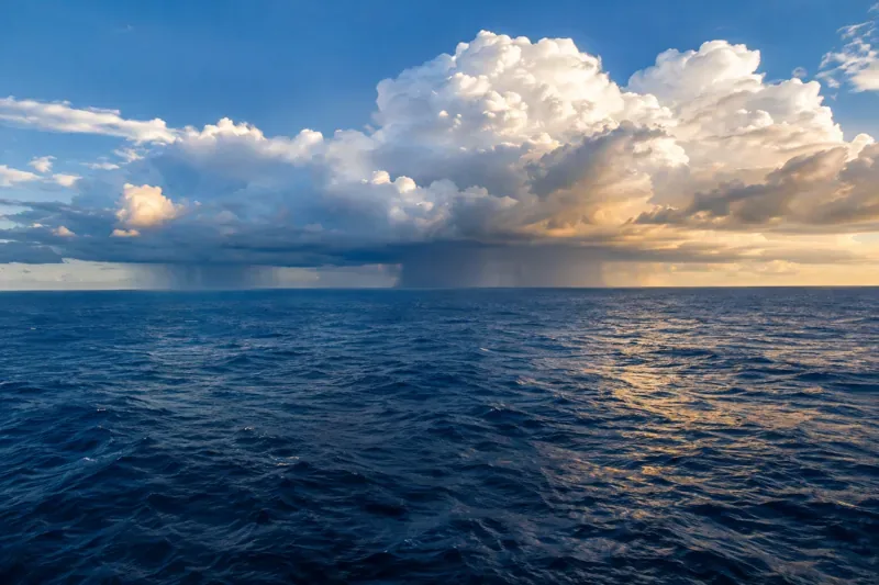
Illustrative ocean scene showing rainfall clouds over water. This generated image is not a satellite observation or a photograph of the current El Niño event.
What is happening with El Niño in November 2026?
NOAA's Climate Prediction Center reported a Niño-3.4 sea-surface temperature anomaly of +2.5°C in its November 12 discussion, alongside unusually warm conditions beneath the eastern equatorial Pacific and wind patterns consistent with a coupled El Niño event. The same advisory noted stronger-than-usual rainfall and convection in the central-to-eastern Pacific and reduced convection near Indonesia. These measurements describe a large-scale climate state, not temperatures at every beach or ocean location.
Forecasters expect the episode to strengthen before weakening in early 2027. NOAA emphasized that even a very strong event cannot guarantee canonical El Niño impacts in every region. See the official November 12 ENSO Diagnostic Discussion and NOAA ENSO probability outlook for the underlying assessment and updates. NOAA scheduled its next monthly discussion for December 10, 2026; that is a scheduled release date, not evidence of a future outcome.
What causes El Niño in the Pacific Ocean?
Under typical conditions, easterly trade winds push warm surface water westward along the equator toward Indonesia and Australia. This helps cooler, nutrient-rich water rise near the eastern Pacific, a process called upwelling. Warm water in the western Pacific encourages rising humid air and abundant thunderstorms, while air often sinks farther east. Scientists call this east–west atmospheric circulation the Walker circulation.
During El Niño, the trade winds weaken or sometimes reverse. Warm surface water can spread eastward, the eastern Pacific's usual upwelling weakens, and heat and moisture are redistributed. Rainfall and rising air shift toward the central or eastern equatorial Pacific. The wind changes and ocean warming reinforce each other, which is why scientists assess both the ocean and the atmosphere instead of relying on a single temperature measurement.
This is part of the El Niño–Southern Oscillation, or ENSO. Its opposite phase, La Niña, involves cooler-than-average central and eastern tropical Pacific conditions and a different atmospheric response. ENSO-neutral describes periods without either sufficiently established coupled pattern. The cycle is irregular: El Niño events generally recur every two to seven years and often persist for roughly nine to 12 months. NOAA explains the mechanism in its ENSO overview, while NASA’s examination of Pacific winds, currents, and teleconnections shows why deep-ocean heat matters.
How does El Niño change weather around the world?
The Pacific covers an enormous share of Earth's surface, so shifting its tropical heat source can redirect atmospheric circulation over distant continents. Scientists call these far-reaching connections teleconnections. Changes in tropical rainfall generate atmospheric waves that can influence the position and strength of jet streams, affecting where cold air, moisture, and storms travel.
Some recurrent relationships are well established: Indonesia and parts of Australia often face increased drought or heat risk during El Niño, whereas parts of western South America can receive unusually heavy rainfall. Marine ecosystems near Peru and Ecuador may change when nutrient-rich upwelling decreases, affecting fish distributions and fisheries. In the tropics, rainfall shifts can also interact with crop growing seasons and wildfire conditions. None of these effects occurs uniformly across entire countries, and other climate influences can amplify or counteract them.
El Niño can also affect tropical cyclones: the atmospheric circulation associated with it often increases vertical wind shear over the Atlantic, which can suppress Atlantic hurricane activity, while conditions may become more conducive to storms in parts of the eastern and central Pacific. This is a basin-wide tendency, not a promise that hurricanes cannot form or make landfall.
What does El Niño usually mean for U.S. winter weather?
In many El Niño winters, a stronger or more southerly Pacific jet stream carries moisture and storms across the southern United States, raising the odds of above-average precipitation in some areas from California and the Southwest through the Gulf Coast and Southeast. Parts of the northern United States, including areas near the Great Lakes, more often experience warmer-than-average winter conditions. Temperature and precipitation signals can differ, however, and some locations receive little recognizable El Niño effect.
The northeastern United States, mountain regions, and individual coastal communities cannot be assigned a single deterministic outcome from ENSO alone. Arctic air outbreaks, blocking patterns, sea-surface temperature anomalies elsewhere, and random weather variability can overwhelm the seasonal signal. A wetter-than-average season also does not automatically mean more damaging floods: storm intensity, drainage, antecedent soil moisture, and local terrain determine impacts.
How do scientists measure and forecast El Niño?
Researchers combine ship and buoy observations, ocean floats, satellites, subsurface heat measurements, atmospheric pressure, trade winds, and tropical rainfall. A commonly watched region, Niño-3.4, lies in the east-central equatorial Pacific. An anomaly measures its temperature departure from an established average; it is not the absolute temperature of the water. NOAA also uses its Relative Oceanic Niño Index (RONI) for current probability assessments, accounting for warming relative to the broader tropical ocean.
Models then estimate how the coupled ocean-atmosphere system may evolve over overlapping three-month seasons. Forecast skill varies by season and lead time, and a high probability of El Niño persistence does not translate into a high probability of any one storm or exact local rainfall total. It is more accurate to read an ENSO advisory alongside NOAA's seasonal temperature and precipitation outlooks and the local National Weather Service forecast.
What happens next, and what should readers watch?
As the 2026–27 Northern Hemisphere winter approaches, forecasters will monitor whether ocean warmth, winds, and tropical rainfall continue reinforcing one another. If the official projections hold, El Niño may continue to influence broad seasonal risks into early 2027, before beginning to weaken. The timing, intensity, and exact weather consequences remain conditional on subsequent observations and atmospheric evolution.
For practical interpretation, check the latest ENSO diagnostic, then look at seasonal outlook probabilities for your region. Use short-range forecasts and warnings for travel, flooding, snow, heat, and other immediate hazards. The central lesson is that El Niño changes the likelihood of weather patterns across the globe; it does not control every local weather event.
FAQ
Does El Niño make the whole world warmer?
No. It can raise global-average temperatures by releasing more Pacific Ocean heat into the atmosphere, but regional temperature responses vary, and some areas can be cooler than usual.
Is El Niño the same as climate change?
No. El Niño is a naturally recurring ocean-atmosphere cycle. Human-driven climate change is a long-term warming trend, and the two can interact in their effects on weather and temperatures.
Does a strong El Niño guarantee a wet winter in the United States?
No. Strong events can increase the odds of wetter-than-average conditions in portions of the southern U.S., but the outcome in any particular location remains uncertain.