Home
» Today
»
Polar Vortex Forecasts in Canada: Local Alerts and November 11, 2026 Outlook
Polar Vortex Forecasts in Canada: Local Alerts and November 11, 2026 Outlook
Information checked: November 11, 2026, at 12:07 UTC (UTC+00:00). This is the source-review time, not the issue time of a Canadian weather warning or a forecast model run.
Polar vortex forecasts for Canada are attracting attention as new upper-atmosphere model guidance points to a possible early-season disruption. In an ECMWF-derived ensemble run initialized November 11, 2026, at 00:00 UTC (UTC+00:00), all 50 members indicated a reversal of Arctic stratospheric winds by November 25. That is a strong model signal, not proof that a cold outbreak has already occurred or that Toronto, Winnipeg, Calgary, Montreal, or any other city will face extreme cold on a particular date. The monitor is independent and explicitly does not constitute an official Canadian weather forecast.
For Canadian households, the immediate decision is simpler: check Environment and Climate Change Canada (ECCC) for your own community’s latest temperature, wind chill, precipitation, and active alerts. The official information reviewed for this article did not establish a single nationwide polar-vortex cold emergency. Weather hazards can nevertheless be significant in individual regions, and local warnings may change quickly.
Destaques
New model guidance suggests an unusually weak Arctic polar vortex, but the timing and surface-weather impacts across Canada remain uncertain.
Use ECCC Weather Information map or WeatherCAN to check your exact Canadian city or community, not a national “polar vortex” headline.
Pay closest attention to forecast low temperatures, wind chill, alert timing, and any snowfall, freezing-rain, or blizzard warnings.
Canada’s November–January seasonal outlook describes broad three-month probabilities, not the date or severity of an individual cold snap.
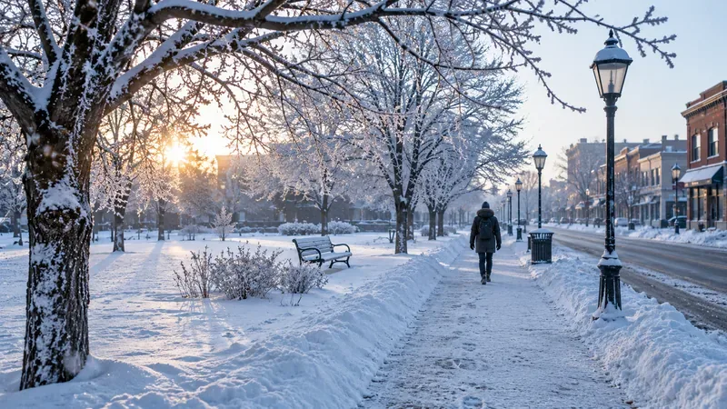
Illustration of winter conditions in a Canadian-style community. This is not a photograph of a verified November 2026 weather event or a specific location.
What do the latest November 2026 polar vortex forecasts show?
The ECMWF-derived polar vortex ensemble monitor, using publicly available European Centre for Medium-Range Weather Forecasts (ECMWF) model output, reported 50 out of 50 traditional ensemble members projecting a reversal of winds around the Arctic vortex by November 25 in its November 11 00:00 UTC run. The model examines winds roughly 30 kilometres above the ground, rather than temperatures measured at homes or airports. As the project’s monitor methodology explains, those counts are raw ensemble shares and have not been calibrated into reliable real-world probabilities. A 50-for-50 result therefore should not be described as a guaranteed event, much less a guaranteed Canadian deep freeze.
ECCC’s Canada’s Changing Climate Report distinguishes the winter stratospheric vortex from the lower-level jet stream that steers much of Canada’s daily weather. Changes high above the Arctic can influence circulation patterns later, but their effects vary by region and are not automatic. A weakened vortex does not mean the entire country will experience the same temperatures; some regions could be relatively mild while others see Arctic air or stormy conditions.
Another near-term signal comes from the U.S. National Weather Service Weather Prediction Center: its November 11 short-range discussion described an Arctic air mass being drawn from northeastern Canada into the eastern United States later in the week. That U.S. outlook is relevant large-scale context, but it is not a substitute for an ECCC forecast or alert for any Canadian municipality.
How can I check whether a polar vortex will affect my area in Canada?
Find your forecast location. Open ECCC Weather Information map and use the location finder for your city or nearby community. In rural or remote regions, verify that the selected forecast location represents where you actually live or travel.
Read the next 24 hours first. Check hourly temperature, wind, wind chill when displayed, and changing precipitation. ECCC’s ECCC hourly forecast guide explains that hourly tables show a more detailed short-range view than a broad daily headline.
Review the seven-day forecast. Look for overnight lows, successive cold nights, rapid temperature drops, strong winds, and any significant snow or ice. Be cautious about a specific date beyond several days; forecasts become less certain further out.
Open every active local alert. In the official weather map, select a colored alert area, or use the alert table to find your province, territory, and forecast region. The ECCC map instructions explains how to read the boundaries and alert details.
Set up mobile notifications. The free WeatherCAN app supports saved locations, weather alert notifications, and customizable low-temperature or wind-chill notifications, as described in the official WeatherCAN app guide. Recheck before commuting, school activities, or long drives.
Time-zone reminder: Canada spans multiple time zones. Alert start and end times should be read in the time zone specified in the official bulletin for that location, not assumed to be uniform nationwide. ECCC’s weather site has also posted a notice that some displayed times may be affected by recent provincial or territorial time-zone changes; the alert text and official forecast remain the preferred reference. Always verify the date as well as the clock time for overnight hazards.
Which forecast details matter more than the phrase “polar vortex”?
Air temperature and wind chill
Air temperature helps you judge the baseline cold, while wind chill describes how wind increases heat loss from exposed skin. ECCC says wind chill appears in forecasts when temperatures are below 0°C and winds reach at least 5 km/h. A dangerous temperature can also occur with little wind. According to the ECCC cold warning guidance, the department issues cold warnings when local temperature or wind-chill impacts warrant them; it does not issue a separate category of wind-chill warnings under its current system. Thresholds differ by region because climate and risk differ across Canada.
Snow, freezing rain, visibility, and travel
Very cold air does not always mean heavy snow. A dry Arctic air mass might produce little precipitation, while a changing storm track can bring snow squalls, ice, blowing snow, or poor visibility. Check the specific hazards for your route, especially if you are crossing provincial boundaries or heading into higher terrain. Radar shows where precipitation is occurring, but it does not replace forecasts of future temperatures, wind chill, or ice formation.
How long the cold lasts
One cold morning and a multiday cold spell require different preparations. Look for the expected beginning and ending of any cold warning, several consecutive low-temperature nights, and risks to exposed skin, outdoor work, pets, vehicles, and heating systems. Reassess whenever the forecast changes.
What do yellow, orange, and red Canadian weather alerts mean?
Under ECCC’s current color-coded system, yellow indicates potentially hazardous weather with generally moderate or localized impacts; orange indicates more serious impacts; and red marks the highest level of risk. The system also distinguishes warnings (hazardous weather is occurring or expected, so take action), watches (conditions favour a potential hazard, so prepare), and advisories (significant conditions may require action). Read the full alert for its exact area, confidence, duration, likely impacts, and recommended steps rather than relying on color alone. See the official ECCC weather alert guide.
No alert banner is not a promise of comfortable weather. A person outdoors for hours may still face cold-related injury at temperatures that do not meet the regional warning criteria. Forecasts and warning maps should be refreshed as conditions develop.
Can Canada’s winter 2026–27 seasonal forecast predict a local polar vortex outbreak?
No. The official Canadian seasonal forecast published a three-month temperature outlook issued November 1, 2026, covering November and December 2026 through January 2027. These maps estimate probabilities that average temperature will be above, near, or below normal over the whole period; they do not say which day your neighborhood will fall below a certain temperature or receive a cold warning.
The official seasonal forecast user guide recommends checking forecast probabilities alongside historical skill and reliability. Even a greater-than-normal chance of a cold season does not establish that any given week will feature a polar-vortex-driven cold snap. Use seasonal information for broad planning, weekly forecasts for upcoming activities, and current warnings for immediate safety decisions.
What should Canadian households do if extreme cold is forecast?
Adjust outdoor activities around the coldest or windiest hours. Wear insulating layers, a wind-resistant outer layer, a hat, mittens, and footwear suitable for ice and snow; cover exposed skin.
Check on children, older adults, people with health conditions, and neighbours who may have difficulty accessing heat or supplies.
Check local road reports before driving and carry winter supplies. Postpone unnecessary travel during severe winter warnings.
Keep medications, drinking water, nonperishable food, flashlights, batteries, and ways to receive alerts ready. Canada’s Canadian emergency kit checklist advises supplies for at least 72 hours.
Prepare for heating or power disruptions, but never run a generator, barbecue, or camp stove indoors or in an attached garage because of carbon monoxide poisoning risk.
These are practical precautions rather than a forecast that all of Canada will be hit. The Government of Canada winter-storm preparedness guide also advises preparing household and vehicle plans in advance of winter storms. If your municipality opens warming centres or issues instructions, follow the local public safety authority.
FAQ: Polar vortex forecasts in Canada
Is a polar vortex warning the same as an extreme cold warning?
No. “Polar vortex” describes a large-scale atmospheric feature. ECCC issues location-specific alerts, including cold warnings and other winter hazard warnings, based on conditions and expected impacts.
Where can I find an accurate polar vortex forecast for my Canadian city?
Does a weak polar vortex guarantee a freezing December in Canada?
No. Upper-atmosphere model signals do not determine the exact timing, location, or severity of surface weather. Review updated ECCC forecasts as winter progresses and distinguish projected outcomes from issued warnings.
Source-check note: Guidance and forecast information were checked against ECCC’s official weather and warnings pages, the November 2026 Canadian seasonal forecast, Canada’s Changing Climate Report, a documented ECMWF-derived model monitor, and official federal winter preparedness guidance. A specific nationwide cold outbreak was not confirmed by those checks.