Home
» Today
»
Oxford Street Pedestrianization: What It Means for Shoppers, Travel, and Access
Oxford Street Pedestrianization: What It Means for Shoppers, Travel, and Access
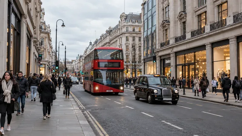
An illustrative view of a busy London shopping street, with shoppers, a bus, and a taxi; Oxford Street’s new traffic-free section changes how people use nearby routes.
Oxford Street pedestrianization is now underway, but the change applies to a defined section rather than the entire shopping street. As of Tuesday, October 27, 2026, the stretch between Orchard Street and Great Portland Street is traffic-free. The first section is nearly one kilometer long and opened on Monday, October 26. It affects how visitors arrive, where buses stop, and where taxis can collect passengers. The Oxford Street Development Corporation’s launch notice describes the traffic restriction as permanent, while the first layout and public-space improvements will be refined in stages.
What changed on Oxford Street
Between Orchard Street and Great Portland Street, private cars, buses, taxis, private-hire vehicles, bicycles, e-bikes, e-scooters, and pedicabs cannot travel along the pedestrianized section. Emergency vehicles retain access. Mobility scooters are allowed. Freight and servicing vehicles can enter by approved routes during a limited overnight window. The restriction does not mean that all of Oxford Street, from Marble Arch to Tottenham Court Road, has become vehicle-free.
The distinction between permanent traffic rules and temporary street design is useful for planning a visit. The road closure is in effect, but OSDC says the first public-space layout is transitional. It is collecting feedback from shoppers, workers, residents, businesses, and accessibility groups before final improvements. That means visitors should expect a pedestrian-first street now, while some landscaping, seating, and wayfinding are still to come.
How bus travel and taxi access work now
Transport for London changed bus routes ahead of the opening. Some services no longer pass through the traffic-free section, and several stops moved to nearby streets. The current TfL Oxford Street travel page lists the live arrangements:
What to check
Current change
What it means for visitors
Routes ending at Marble Arch
7, 94, N7, N113, and N137
Do not expect these services to carry you through to Oxford Circus on Oxford Street.
Routes rerouted around the closure
98, 139, 390, N98, and N207
Look for replacement stops on Wigmore Street, Henrietta Place, and Cavendish Place.
Other routes
Several have stop or route changes
Check the exact direction and stop before setting out.
TfL says the replacement stops are about 200 meters from the traffic-free area. That is a short walk for many visitors, but it can add time for someone with limited stamina, luggage, young children, or a mobility aid. Some online bus “spider maps” are currently marked as out of date, so use TfL’s current bus map and journey planner instead of an old screenshot or saved route. Bus changes took effect at 1:00 a.m. on Saturday, October 24, 2026, in London, BST (UTC+01:00). The UK clocks went back on October 25; London was on GMT (UTC+00:00) when the traffic-free section opened on October 26. The UK government clock-change calendar confirms those seasonal dates.
Taxis and private-hire vehicles cannot enter the closed section either. TfL lists taxi ranks within 100 meters of the pedestrianized area, including ranks outside the closure and on nearby roads such as Orchard Street, Duke Street, and Great Portland Street. Ask for a drop-off or pickup point on the surrounding street, not on the pedestrian-only stretch, and check the current taxi-rank map before booking an accessible ride.
What the change means for accessibility
A traffic-free pavement can make walking and wheeling easier by reducing vehicle conflicts and creating more room. TfL’s accessibility assessment also describes a level pedestrian environment and planned seating and rest areas as benefits. Its current travel page identifies Bond Street and Tottenham Court Road as nearby step-free stations. They may be useful options for a step-free journey, but check station entrances and live lift status for the specific route you need.
There is a trade-off: buses and taxis no longer reach the middle of this stretch, and the nearest replacement stops and ranks sit outside it. Mobility scooters remain allowed, but cycles, e-bikes, e-scooters, and pedicabs do not. TfL’s consultation materials said the number of Blue Badge parking bays in the surrounding area would be maintained; that does not provide curbside vehicle access on Oxford Street itself. If a Blue Badge bay, taxi, or shorter walking distance is essential, confirm the current bay or pickup location on the official map before traveling.
The pedestrian route also crosses streets that still carry north-south traffic. TfL lists crossings at roads including Duke Street, Stratford Place and Davies Street, Vere Street and New Bond Street, and Holles Street and Harewood Place. Use the marked crossing points at these junctions rather than assuming the whole area is one uninterrupted plaza. Temporary construction can also affect nearby streets, so allow extra time and check the live travel notice.
Shopping, deliveries, and what is still planned
For shoppers, the immediate change is more space to move between stores without buses and taxis sharing the Oxford Street roadway. That may make browsing and stopping easier, but the launch itself does not prove that footfall or sales have increased. Those outcomes need to be measured over time. OSDC says the initial weeks will involve limited construction to reduce disruption during the Christmas shopping period, with more than 50 trees, over 100 seats, two public squares, rest areas, and improved signs planned by the end of spring 2027. The final design is still expected to use feedback from people who live, work, shop, and visit nearby.
Businesses still have a way to receive stock and servicing. TfL allows approved freight and loading vehicles onto the pedestrianized section between 12:00 a.m. and 7:00 a.m. every day, using designated access routes. On the article’s October 27, 2026 update date, London is on GMT (UTC+00:00), so that window is midnight to 7:00 a.m. GMT. When London observes British Summer Time (BST, UTC+01:00), the same stated window follows the local clock and its UTC conversion shifts by an hour. Shops may therefore continue to operate while delivery traffic is limited to the overnight period.
What to expect on surrounding streets
Removing traffic from Oxford Street shifts some journeys to parallel and crossing roads. TfL’s pre-opening traffic model projected increased traffic on some nearby links, including southbound Regent Street during its modeled morning and evening peaks. Those are forecasts, not measured results after the October 26 opening. Westminster City Council also called for a full environmental assessment and warned that diverted traffic could affect noise and air quality on nearby streets. That is the council’s stated concern; the actual effect should be judged from monitoring after the change, not assumed from either a forecast or a campaign statement.
The practical takeaway is to plan the last part of the trip, not just the journey into central London. Before leaving, confirm your bus route and stop, decide which Tube or Elizabeth line station best matches your destination, check taxi ranks or Blue Badge parking if needed, and allow time for the extra walk. Use the current TfL journey planner and the Oxford Street bus-change list. The first traffic-free stretch is open; its long-term shopping, traffic, and accessibility effects are still being tested through real use.