Home
» Today
»
NWS Radar Outage Rumors Debunked: How Forecasters Track Storms — November 14, 2026
NWS Radar Outage Rumors Debunked: How Forecasters Track Storms — November 14, 2026
Information checked: November 14, 2026, 04:08 UTC (November 13, 11:08 p.m. Eastern Standard Time, UTC−05:00).
Reports that the entire U.S. National Weather Service (NWS) weather radar network went down on November 13 were inaccurate. The agency clarified that its radars were operating normally, and its Central Operations office explicitly reported at 23:01 UTC on November 13 (6:01 p.m. EST, UTC−05:00) that radar data systems and network communications were functioning without widespread outages. Earlier warnings about website access and communications problems, plus a stale webpage labelled “National Radar Outage,” contributed to confusion. The practical distinction is important: a weather-data website may fail or show old products while the physical Doppler radars continue scanning the sky.
The incident raises a useful question for anyone tracking severe weather near the Canada–U.S. border: what happens when a radar station, data link, or public map really is unavailable? Forecasters do not rely on one website or one sensor. They combine overlapping radar coverage, satellite observations, weather stations, atmospheric soundings, reports from trained observers and numerical forecast guidance. Those backups help maintain situational awareness, though none perfectly replaces a nearby functioning radar during fast-changing storms.
Destaques
NWS officially rejected claims of a nationwide radar shutdown on November 13, 2026.
An NWS operational notice at 23:01 UTC confirmed radar data and network communications were normal; an earlier website-access warning should not be confused with stopped radar antennas.
Forecasters can turn to neighbouring radars, satellites, ground sensors, storm spotters and model guidance if a radar feed fails.
For readers in Canada, Environment and Climate Change Canada remains the authoritative source for Canadian watches and warnings.
Did National Weather Service weather radars actually go down?
No nationwide radar failure was confirmed. On November 13, the NWS publicly stated that its radar website was fully operational and that outdated material from isolated webpages had been circulated. Its Senior Duty Meteorologist administrative message carried the 23:01 UTC operational update stating that all NWS radar data systems and network communications were operating normally, with no widespread NWS IT or network outages.
An earlier NWS notice warned of nationwide internet and communications issues that could make weather products inaccessible or outdated. That kind of disruption can affect delivery to users without implying that every WSR-88D radar instrument has stopped collecting observations. The agency did not establish a single nationwide radar hardware fault or a technical root cause for the false radar-outage claim. Nor did it confirm that the NWS website issues were caused by the separate FAA air-traffic communications failure occurring that day.
Why can weather radar maps appear down when radar stations are working?
A radar system has several layers. The antenna transmits pulses, receives echoes from precipitation and processes information about where rain, snow or hail may be occurring and how targets are moving. That processed data then travels through communications networks to forecast offices, national mosaics, websites and third-party apps. Trouble at any later stage can create a blank map, missing scans or stale timestamps even when the radar itself remains operational.
The NWS radar portal provides individual radar-station products, a nationwide radar mosaic and location-based weather displays. A failure in one display layer need not imply a failure in every underlying radar. Conversely, a true outage of a local radar can leave a geographic gap even when the national map still loads. The date and time of the latest scan are therefore more informative than simply whether a colourful map appears on screen.
How do meteorologists track storms without a nearby radar?
Neighbouring Doppler radars and regional mosaics
Forecasters first look for observations from surrounding radar sites and cross-check the scan times. Adjacent radars may capture the same storm from another angle, but beams rise above the ground with distance and can miss shallow or low-level features. Mountains and other terrain further limit coverage. Thus an overlapping radar may reveal a larger storm pattern without resolving the near-surface winds needed for certain tornado or flash-flood assessments.
NOAA satellites and lightning observations
Geostationary satellites show cloud movement, cloud-top temperatures, moisture and the development of convective systems across broad areas. Lightning information can help identify electrifying thunderstorms and rapidly intensifying convection. But satellites mainly observe cloud properties from above: they cannot measure near-ground precipitation structure or radar-derived wind signatures in the same way as a local Doppler installation.
Surface stations, aircraft, soundings and storm spotters
Airport weather observations, automated surface stations and personal reports supply ground truth on rain, visibility, wind gusts and pressure changes. Upper-air weather balloons and aircraft observations describe winds and temperature structure aloft. Trained storm spotters and emergency managers may report hail, damage, flooding or funnel clouds. These observations matter most when remote-sensing data are incomplete, but individual reports are geographically limited and must be evaluated carefully.
Forecast models and human analysis
Numerical models provide short-term and broader predictions of storm development; forecasters compare them with fresh observations rather than treating a forecast as a live measurement. The NWS forecast-process guide explicitly describes combining radar, satellite, surface observations, radiosondes, aircraft information and river gauges. A missing radar feed increases uncertainty about exact storm location and intensity; it does not mean weather services stop issuing forecasts or warnings.
What should people do if a radar app shows no data?
First, check the product timestamp and compare it with the clock; a frozen animation can look deceptively current. Second, check NWS forecasts and warnings and the official U.S. radar portal rather than relying exclusively on one third-party map. If the site remains unavailable, consult your local NWS office’s official channels and emergency notifications. Do not interpret a blank radar image as evidence of clear skies.
In Canada, use Environment and Climate Change Canada’s official weather service for Canadian forecasts, radar, satellite imagery and watches or warnings. Near the border, a U.S. radar may cover some Canadian territory and Canadian radars may help provide broader context, but the jurisdiction issuing an alert for your location remains important. Enable official phone alerts and follow local emergency guidance if severe conditions are developing.
What happens next if another radar or communications outage occurs?
Forecasters can adjust their analysis and seek alternative feeds, while technical teams investigate whether the problem involves a station, transmission path or public application. The operational impact depends on its location, duration, overlap with other radars and the weather occurring at that moment. A short interruption on a quiet day is materially different from losing low-level radar coverage as a dangerous thunderstorm crosses a populated area.
The verified November 13 update does not establish a nationwide radar outage or show that warning operations stopped. It does, however, illustrate why the public should distinguish sensor performance from website availability, and why agencies maintain several independent ways of observing hazardous weather.
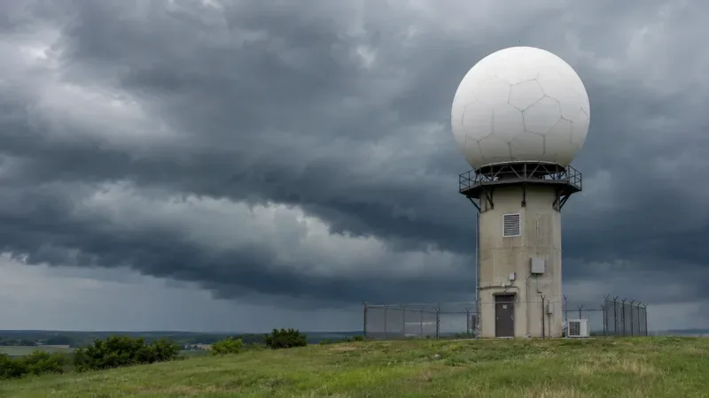
Illustrative image of a weather radar installation beneath approaching storm clouds; this is not a photograph of an NWS outage site.
FAQ
Were all U.S. NWS radars offline on November 13, 2026?
No. NWS stated its radar services were operating normally, and its 23:01 UTC operational message reported no widespread radar-data or network outage.
Can meteorologists still issue severe weather warnings when a radar fails?
Yes. They use other radar sites, satellites, weather stations, storm reports and forecast guidance, although a missing local radar can reduce confidence in some near-ground details.
Where should Canadians check weather alerts during a U.S. radar website problem?
Use Environment and Climate Change Canada for Canadian alerts and forecasts, and follow local emergency notifications. U.S. NWS alerts remain relevant for locations on the American side of the border.