Home
» Today
»
UK Tuesday Snow Warning: How to Prepare for Commute Disruption | Nov. 16, 2026
UK Tuesday Snow Warning: How to Prepare for Commute Disruption | Nov. 16, 2026
Checked November 16, 2026, at 9:18 a.m. UTC (9:18 a.m. GMT in the United Kingdom). The Met Office has issued a yellow warning for snow across parts of northern England, the Midlands, Yorkshire and southern Scotland for Tuesday, November 17, from 12:00 a.m. until noon GMT (UTC+00:00). The greatest commuting concern is snow on higher routes, potentially lengthening journeys by car, bus and train. Anyone travelling before midday should check their specific route and service before leaving, rather than assuming the warning means every road will be snow-covered.
The Met Office expects accumulating snow mainly at elevations of 100 meters or above. Where snow settles, 1–5 centimeters is possible, while some areas above 300–400 meters could receive 5–15 centimeters. Strong easterly winds could cause local drifting; snow is expected to turn back to rain in many places during the morning. These figures are forecast estimates, not confirmed accumulation or reports of closures. The warning also identifies a small chance of power outages or reduced mobile service. Check the live Met Office weather-warning map for changes.
Destaques
Tuesday's snow warning runs from 12:00 a.m. to noon GMT (UTC+00:00) on November 17, 2026.
Higher-level roads are more exposed; the warning encompasses parts of northern England, the Midlands, Yorkshire and southern Scotland.
Check road conditions and rail or bus operators before travelling; allow extra time or delay a nonessential trip.
Carry warm clothing, water, a charged phone and winter supplies; reduce speed and increase following distance if driving.
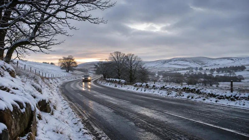
Illustration: A snow-lined hill road at dawn. This generated image is not a photograph of conditions on November 17, 2026.
What time is the Tuesday snow warning in force?
The Met Office's yellow snow warning applies from midnight through 12:00 p.m. on Tuesday, November 17, in UK Greenwich Mean Time, GMT (UTC+00:00). The UK has already returned to standard time after the autumn clock change. That is the same interval as 00:00–12:00 UTC, and it covers the morning commute. It does not mean every affected location will experience continuous snow for all 12 hours.
The warning was issued at 5:15 p.m. UTC on Sunday, November 15. The Met Office says a northward-moving band of precipitation could turn to snow as it encounters colder air, especially over higher ground. On lower ground, any falling snow may be brief and melt quickly. The subsequent change back to rain is another reason that conditions may differ sharply over relatively short distances.
Which commutes need the most preparation?
The warning covers named local authorities across parts of Derbyshire, Nottinghamshire, Greater Manchester, Lancashire, Cumbria, Northumberland, Durham, Yorkshire and Staffordshire, as well as parts of southern Scotland. A local authority's inclusion does not imply equally severe conditions throughout its area. Altitude, exposure, wind and the timing of precipitation will matter considerably.
Drivers using Pennine routes, rural hill roads and exposed passes should be particularly attentive to weather and road reports. Higher elevations can experience snow and slush even when a nearby town at lower altitude sees only rain. The Met Office specifically warns that snow combined with strong easterly winds could cause drifting on higher-level routes. It anticipates longer journey times by road, bus and rail but does not, in the warning itself, confirm a named road closure or train cancellation.
How should you prepare your car before Tuesday morning?
Before travelling, check the warning and local forecast, inspect the route for road closures, and consider whether the journey can be postponed, shifted later or completed remotely. If the trip is essential, tell someone where you are going and when you expect to arrive. Aim for main routes that are more likely to be treated, but never assume gritting guarantees an ice-free road.
Check visibility: Clear all windows, mirrors, lights and the roof of snow before setting out. Make sure wipers and screenwash are working.
Check vehicle condition: Look at tire tread and pressures, fuel or battery charge, and whether lights and heating work properly.
Pack a winter kit: Keep an ice scraper, de-icer, warm clothing, blanket, sturdy footwear, flashlight, water, food and a charged phone with a car charger.
Plan a backup: Know a safer alternate route or a place to stop if conditions deteriorate; do not rely solely on a phone navigation app.
The Met Office and National Highways both advise being prepared for longer stopping distances in snow and ice. Reduce speed, leave a much larger gap to the vehicle ahead, brake and steer gently, and avoid sudden acceleration. Stopping can take as much as 10 times longer in icy conditions, depending on conditions. If driving becomes unsafe, seek a safe place to stop rather than attempting to push through.
What should train and bus passengers do differently?
Snow forecasts are not the same thing as announced service suspensions. Check the website or app of your specific rail or bus operator shortly before leaving, then check again if a journey involves a connection. Where possible, choose an itinerary with more time between connections and a reliable alternative if a service is delayed. Keep warm layers, water and a charged phone handy while waiting outside.
For anyone heading to a medical appointment, school or work at a fixed time, it may be worth contacting the destination in advance to discuss a backup arrangement. Employers and schools should rely on their own operational announcements; the Met Office warning does not automatically close workplaces, schools or transport networks.
How can pedestrians and cyclists stay safer on icy streets?
Cold mornings can make untreated sidewalks, footbridges and cycle paths slippery even if a main road appears wet rather than snowy. Wear shoes with good grip, take smaller steps on suspect surfaces and allow more time for short walks. Avoid carrying so much that you cannot balance or use a handrail. Cyclists should be particularly cautious on shaded bends, painted road markings and untreated paths; if grip is uncertain, walking or taking another mode of transport may be safer.
People with limited mobility and those who depend on a particular bus or train should consider arranging assistance or a flexible plan before the morning commute. The overnight cold and possible localized ice are practical risks distinct from the forecast snow depth.
What could change before the morning commute?
The warning can be amended, extended, narrowed or canceled as forecast confidence changes. Snow and rain boundaries are especially sensitive to temperature and elevation. The Met Office's national outlook describes a wet and windy Tuesday more broadly, so people outside the yellow warning zone should still check local rainfall and wind conditions rather than treating this as a nationwide heavy-snow forecast.
As of this check, the official warning describes possible delays, drifting and limited infrastructure impacts; it is not evidence that any particular train has been canceled, road closed or power supply interrupted. Monitor the Met Office warning page, the national forecast, official Met Office snow-and-ice travel advice, and live updates from the relevant road authority or transit operator. People travelling through multiple regions should check each part of the route.
Frequently asked questions
When does the UK snow warning end on Tuesday?
The currently published Met Office yellow snow warning is due to end at noon GMT (12:00 UTC) on November 17, 2026. Check for revisions before travelling.
Will every city in the warning area receive 5–15 centimeters of snow?
No. The higher amount is a possibility for some areas above roughly 300–400 meters. Forecast accumulations are generally lower elsewhere, and some lower areas may see rain or brief, melting snow.
Should I cancel my commute because of a yellow snow warning?
Not automatically. Check your actual route, elevation, current road or transit conditions, and your ability to travel safely. Delay or change nonessential travel if conditions are poor, particularly on exposed higher routes.