Home
» Today
»
Hurricane Tracker: How to Follow Storms and Get Reliable Alerts
Hurricane Tracker: How to Follow Storms and Get Reliable Alerts
Reviewed September 23, 2026. A hurricane tracker is most useful when it answers two different questions: Where is the storm likely to go? and What should I do where I am? No single map, app, or alert channel handles both jobs perfectly. The safest setup uses an official forecast source for the big picture, a local warning source for location-specific hazards, and at least one alert method that can reach you without requiring you to keep checking a screen.
For U.S. users, the National Hurricane Center (NHC) should be the primary source for tropical cyclone tracks, intensity forecasts, wind probabilities, storm-surge products, and key messages. Local National Weather Service offices and emergency managers add the neighborhood-level detail that a national storm map cannot provide.
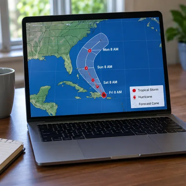
A hurricane track map is useful for the regional picture, but the forecast cone should be paired with local warnings because damaging weather can occur well outside the center track.
Which hurricane tracking option fits your need?
Option
Best for
Main strength
Main trade-off
NHC / Hurricanes.gov
Storm track, intensity, wind, surge, timing
Authoritative tropical cyclone forecast products
Not a substitute for street-level evacuation or local emergency instructions
Local NWS pages and alerts
Your county or forecast area
Local watches, warnings, flood and wind details
You may need to know which local office covers you
Wireless Emergency Alerts (WEA)
Urgent, location-based warnings
Can appear automatically on compatible phones
Not every forecast update becomes a WEA
FEMA app
Multiple saved locations and preparedness
Weather and emergency alerts for up to five U.S. locations
Relies on a smartphone and app notifications
NOAA Weather Radio
Backup alerting at home or during outages
Dedicated 24/7 official warning channel
Requires a separate receiver and usable radio coverage
Commercial weather apps
Convenience, radar, widgets, familiar interface
Often easier to browse quickly
Notification rules, data sources, and update timing vary by app
If you only want to know whether a named storm exists and where it is headed, start with NHC. If you need to know whether to evacuate, shelter, avoid a flooded road, or change travel plans, move from the national track to your local NWS office and local emergency management instructions.
Start with the National Hurricane Center, not a social-media map
The NHC forecast cone shows the probable path of the storm center, not the full area of hazardous weather. The agency explicitly notes that tropical-storm-force and hurricane-force winds can extend well beyond the cone. Its official cone explanation says the operational cone is built from recent official track errors, while the broader NHC graphical product guide explains complementary products such as wind-speed probabilities, arrival time of tropical-storm-force winds, storm surge, and rainfall.
That distinction matters. A user who watches only the center line may falsely conclude that a nearby county is “out of danger.” A better routine is to check three layers: the track cone for overall uncertainty, wind or surge products for the hazard footprint, and local warnings for the action you may need to take.
What changed in 2026?
For the 2026 hurricane season, NHC made its cone graphic with U.S. inland tropical storm and hurricane watches and warnings operational. The agency is also testing an experimental cone built with ellipses that represent along-track and cross-track forecast error differently. During 2026, that experimental product is provided in addition to the operational cone, not as a reason to ignore the standard warning products.
For most consumers, the practical takeaway is simple: do not spend your time choosing between cone designs during an emergency. Use the operational warnings that apply to your location, and treat any cone as a forecast-uncertainty tool rather than a boundary between “safe” and “unsafe.”
Turn on phone alerts before the weather deteriorates
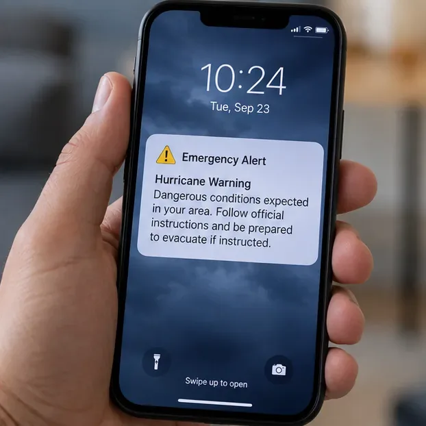
Wireless Emergency Alerts are designed for urgent public-safety messages delivered through participating cellular networks. FEMA’s Integrated Public Alert and Warning System distributes alerts through multiple pathways, including mobile phones, radio, television, and NOAA Weather Radio. A WEA can be extremely useful because it does not depend on you remembering to open a weather app.
System-level emergency alerts can reach a phone without the user repeatedly refreshing a storm tracker, making them an important complement to forecast maps.
On iPhone, Apple says Government Alerts are on by default on supported devices and carriers; users can review them under Settings > Notifications, near the bottom of the screen. See Apple’s Government and Emergency Alerts guidance. On Android, Google documents a Notifications > Wireless emergency alerts section on supported devices, while noting that settings can vary by manufacturer. See Android emergency help.
The trade-off is that system alerts are selective. They are meant to interrupt you for important threats, not to replace continuous storm tracking. That is why “I did not receive an alert” should never be interpreted as proof that no hazard exists. If a hurricane or tropical storm may affect your area, continue checking official forecasts and local instructions.
Use the FEMA app when you care about more than one location
The FEMA app can receive National Weather Service weather and emergency alerts for up to five locations nationwide. That can be useful if you are watching your home, a family member’s city, a vacation property, or a destination on an upcoming trip.
Its advantage is convenience: one app can combine alerts and preparedness information across several places. Its limitation is the same as any smartphone app: notifications can be affected by device settings, connectivity, battery state, app permissions, or user choices. For a household in a hurricane-prone area, it is better as one layer in an alert plan than as the only layer.
Add NOAA Weather Radio when reliability during outages matters
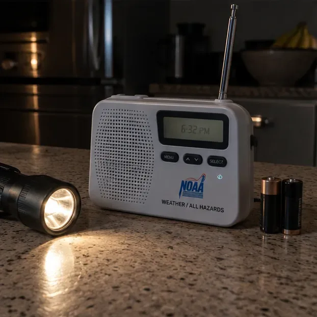
A dedicated NOAA Weather Radio is less visually convenient than a phone, but it solves a different problem. The National Weather Service describes NOAA Weather Radio All Hazards as a nationwide network broadcasting official watches, warnings, forecasts, and other hazard information 24 hours a day. Many alert-capable receivers can sound an alarm when warnings are issued.
A battery-capable NOAA Weather Radio adds a dedicated warning channel when household power, internet service, or phone charging becomes unreliable.
The trade-off is hardware: you need a compatible receiver, the correct local station, and batteries or another backup power source. Radio reception also varies by location. For people who live in coastal, flood-prone, rural, or outage-prone areas, however, that extra hardware can be worthwhile because it reduces dependence on cellular data and home internet.
Do not confuse a hurricane tracker with an evacuation order
A forecast map tells you what the atmosphere and ocean are expected to do. An evacuation order tells you what local authorities want people in a defined area to do. Those are related, but they are not interchangeable. Storm surge zones, bridges, low-lying roads, local shelter capacity, and emergency access can all affect evacuation decisions.
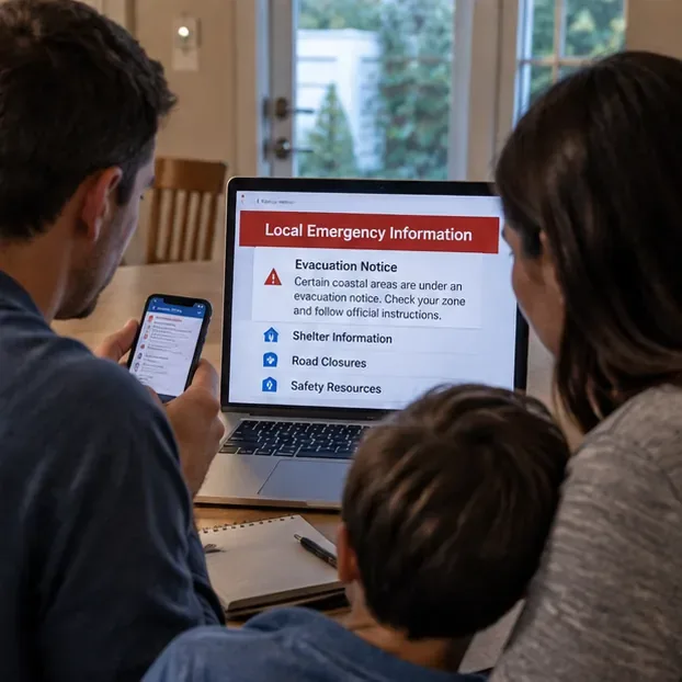
Local emergency information is the action layer: evacuation zones, shelter details, road closures, and other instructions can be more important than the storm center’s exact plotted path.
When local officials tell your zone to evacuate, do not wait for the storm-center line to move closer to your house before acting. Conversely, a broad forecast cone does not automatically mean every location inside it will receive the same impacts. Use local instructions to convert the forecast into a decision.
How often should you refresh a hurricane tracker?
Constant refreshing can create the illusion of precision without improving your decisions. During an active threat, check after official advisory updates and whenever your local NWS office or emergency management agency issues a new warning or instruction. The NHC home page lists advisory times and current storm products. If you are making a time-sensitive decision, such as when to leave a barrier island or when to stop driving, follow the latest local guidance rather than waiting for a visually dramatic change on a map.
A practical setup is to keep one browser tab on NHC, allow emergency alerts on your phone, and identify your local emergency management source before the storm arrives. Add NOAA Weather Radio if losing power or cellular service is a realistic concern.
What about radar, spaghetti models, and social media?
Radar is excellent for seeing where rain bands are now, but it is not a long-range hurricane track forecast. “Spaghetti” model plots can show a spread of computer-model solutions, but individual lines are not official forecasts and may not be equally skillful or even initialized at the same time. Social media can be fast, but screenshots are easily separated from their timestamp, source, or later corrections.
Use those tools for context, not as your final authority. A useful test is whether you can trace the information back to NHC, NWS, FEMA, or a local public-safety agency. If you cannot find the original source, treat the claim as unverified until you can.
A reliable hurricane-alert setup for different users
If you want the simplest setup
Use the NHC website for the storm track and keep Wireless Emergency Alerts enabled. Also bookmark your local NWS office or emergency management page. This minimizes app clutter while still giving you an official forecast plus urgent local alerts.
If you are tracking family in several states
Add the FEMA app so you can monitor alerts for multiple saved locations. Keep NHC for the tropical cyclone forecast itself. This is more flexible than relying only on alerts tied to the phone’s current physical location.
If you live where outages are common
Add a battery-powered NOAA Weather Radio with alert capability. Phones remain useful, but the radio provides a separate communications path and avoids making your entire warning plan depend on charging, cellular coverage, or internet service.
If you like advanced maps and commercial apps
Use them for visualization, radar, widgets, or convenience, but verify critical decisions against official products. Check the app’s data source, timestamp, refresh behavior, and notification settings. The most attractive map is not necessarily the most useful one if you cannot tell when the data was issued.
Find your local National Weather Service office and local emergency management agency.
Confirm that Wireless Emergency Alerts are enabled on your phone.
Check that weather-app notifications are allowed if you rely on an app.
If using a NOAA Weather Radio, test reception and install fresh backup batteries.
Know your evacuation zone and where official evacuation orders will be posted.
Do not rely on one communications channel, especially when power and cellular networks may be disrupted.
The best hurricane tracker is therefore not a single product. It is a small, redundant system: NHC for the official tropical forecast, local authorities for decisions that apply to your area, phone alerts for urgent interruption, and a backup such as NOAA Weather Radio when connectivity is uncertain. That combination is less flashy than chasing every new map, but it is much more useful when the information needs to lead to a real-world decision.