Home
» Technology
»
The Anatomy of Commercial Drones: Hardware Breakthroughs and Autonomous Flight
The Anatomy of Commercial Drones: Hardware Breakthroughs and Autonomous Flight
The most important thing to understand about commercial drones in 2026 is that the airframe is no longer the whole product. The real leap is the integration of sensing, onboard computing, power management, communications, and flight-control software into one coordinated system. That is what lets a drone hold position when GNSS is imperfect, detect obstacles in several directions, follow terrain, collect repeatable data, or complete a planned inspection with much less stick-by-stick piloting.
A recent hardware development makes that shift especially visible. On August 25, 2026, NVIDIA announced Jetson Orin Nano 2, an edge robotics computer aimed in part at delivery and inspection drones. NVIDIA says it delivers twice the inference performance of its predecessor in the same form factor and uses 40% less power at the same performance. That does not make a drone autonomous by itself, but it illustrates the trend: more perception and decision-making can now happen onboard without sending every video frame to the cloud. See the NVIDIA announcement.
If you are evaluating a commercial drone for surveying, inspection, public safety, agriculture, or remote operations, the useful question is not “How smart is this drone?” It is “Which parts of the autonomy stack are actually present, under what conditions, and are they relevant to my mission?”
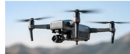
A commercial multirotor carries a stabilized imaging payload in flight. Its real capability depends on the sensors, onboard compute, power system, communications, and flight-control software built around the airframe.
The six hardware layers that define a commercial drone
Layer
What it does
Why it matters in practice
Airframe and propulsion
Provides lift, stability, payload capacity, and weather tolerance.
Determines whether the platform can carry the required sensor and remain controllable in wind.
Power system
Supplies motors, avionics, payloads, compute, radios, and thermal management.
Sets the practical flight-time and turnaround envelope.
Navigation sensors
Combine IMUs, GNSS, barometers, magnetometers, range sensors, cameras, LiDAR, or radar.
Give the aircraft an estimate of position, attitude, velocity, altitude, and nearby obstacles.
Flight computer
Runs stabilization, state estimation, mission logic, perception, and sometimes AI inference.
Converts raw sensor data into control decisions fast enough for flight.
Payload
Captures or acts on mission data: RGB, thermal, multispectral, LiDAR, mapping, lighting, speakers, or third-party devices.
Defines the actual business output.
Communications
Links the aircraft to the pilot, dock, network, cloud, or fleet-control system.
Affects command reliability, live video, telemetry, remote operations, and data transfer.
1. Airframe and propulsion: the foundation still matters
Autonomy cannot compensate for an aircraft that is underpowered, poorly matched to its payload, or operating outside its weather envelope. Multirotors dominate many inspection and public-safety missions because they can hover and position precisely. Fixed-wing or hybrid VTOL aircraft can be better when area coverage and endurance matter more than stationary inspection.
The trade-off is straightforward: bigger motors, propellers, landing gear, batteries, and structural margins can improve payload capability and wind performance, but they add mass. That mass then demands more energy. This is why serious commercial platforms are engineered as systems rather than assembled around one headline specification.
DJI's current Matrice 400 is a useful example of the heavy-duty end of the market. DJI specifies a maximum payload of up to 6 kg and a maximum forward flight time of 59 minutes under controlled test conditions. It also carries an IP55 rating. These numbers are meaningful for inspection or mapping teams, but they should not be read as guaranteed field performance: wind, temperature, payload, flight profile, reserve policy, and altitude all change endurance. See the official DJI Matrice 400 page and specifications.
2. Batteries are becoming operational systems, not just energy packs
The battery remains one of the hardest constraints in electric drone design. More onboard compute and more sensors consume power; heavier payloads increase propulsion demand; cold weather reduces battery performance. The practical breakthrough has therefore been not just energy capacity, but better battery management.
For example, DJI lists the Matrice 400 TB100 battery at 977 Wh, based on a 13-series lithium-ion pack. The same support documentation describes battery self-heating and fast charging, including approximately 45 minutes from 0% to 100% on 220 V in fast-charging mode under stated test conditions. The platform also supports a power-off endurance function that allows battery hot-swapping without a full shutdown. Those details matter to a utility or public-safety fleet because downtime between sorties may matter as much as the maximum minutes in the air.
If your operation involves repeated missions, compare battery turnaround, thermal behavior, cycle life, charging infrastructure, spare-pack cost, and field logistics—not flight time alone.
3. Sensor fusion is the real navigation breakthrough
Older small drones could be described as GPS-guided aircraft with an IMU. Modern commercial systems increasingly use several navigation sources at once. The flight stack may combine GNSS, inertial measurements, barometric altitude, magnetometer heading, optical flow, visual-inertial odometry, rangefinding, stereo cameras, LiDAR, and radar.
Open autopilot documentation shows why this matters. PX4's navigation filter uses an extended Kalman filter to combine measurements and estimate the vehicle state. Its documentation also explains that GNSS data can be rejected when it becomes inconsistent, while alternative sources such as optical flow or visual-inertial odometry can support continued position estimation in some configurations. See the PX4 navigation-filter documentation and its GNSS-degraded flight guidance.
This is especially relevant under bridges, near tall structures, around reflective facades, or in areas where satellite reception is intermittent. It does not mean every drone can safely fly without GNSS. The aircraft must actually have the alternative sensors, calibration, software configuration, and tested operating envelope to do so.
4. Obstacle sensing has moved beyond simple forward cameras
Commercial obstacle avoidance is increasingly multimodal. DJI says the Matrice 400 combines full-color fisheye vision, rotating LiDAR, upper LiDAR, a downward infrared range sensor, and six-direction mmWave radar. That combination is designed to improve sensing across lighting conditions and around thin structures such as power lines.
Skydio takes a different but equally instructive approach with the X10. Its current specifications list six navigation cameras arranged in trinocular groups on the top and bottom, 360-degree obstacle-avoidance coverage, and a 20-meter obstacle-sensing range. It also uses an NVIDIA Jetson Orin SoC alongside a Qualcomm Snapdragon 865 SoC. See the Skydio X10 technical specifications.
For a bridge inspector flying close to steelwork, dense perception and local autonomy can be more valuable than a long radio range. For open-field mapping, the reverse may be true. Match the sensing architecture to the environment rather than assuming that “more sensors” is always better.
5. Edge AI changes what can happen onboard
A conventional flight controller can stabilize a drone and execute a waypoint mission without modern AI. Edge AI becomes important when the aircraft must interpret richer scenes: classify objects, track targets, recognize structures, segment terrain, inspect assets, or make higher-level navigation decisions from images.
Doing that locally reduces dependency on network latency and uplink bandwidth. It also allows the drone to react even if the connection to the cloud is slow or unavailable. NVIDIA's Jetson platform is explicitly designed for low-latency robotics and multi-sensor fusion, and the 2026 Orin Nano 2 update points toward more inference per watt in smaller autonomous machines.
However, “AI-enabled” should not be treated as a safety certification. A useful procurement question is: which decisions are deterministic flight-control functions, which are perception outputs, which are AI-assisted, and what happens when the AI confidence is low or sensors disagree?
6. Communications now include direct radio, cellular, and relay links
For many commercial missions, the communications system is as important as the camera. It carries control commands, telemetry, live video, health status, and sometimes payload data.
DJI says the Matrice 400 can use its enterprise radio system over long unobstructed distances under specified conditions and can use one aircraft as a relay for another. Skydio lists both its direct-connect radio system and LTE/5G connectivity for the X10. These options can help around terrain, structures, or distributed fleets, but advertised range is not the same as legally permitted operating radius.
That distinction becomes critical for remote inspection or drone-in-a-box operations. Cellular coverage, RF congestion, latency, antenna orientation, terrain, and aviation rules may matter more than the theoretical maximum link range.
How autonomous flight actually works
“Autonomous flight” is best understood as a chain of functions rather than one feature.
Estimate: the flight stack fuses measurements into an estimate of position, attitude, velocity, altitude, and uncertainty.
Perceive: computer vision or other algorithms identify obstacles, terrain, structures, or targets.
Plan: mission and path-planning software selects a route or modifies one around constraints.
Control: the autopilot turns the plan into motor commands while stabilizing the aircraft.
Monitor and fail safely: software watches battery state, communications, navigation quality, geofencing, and other limits, then triggers predefined responses when needed.
PX4's collision-prevention documentation is a good example of how one part of this chain is implemented. Sensor data is fused into sectors around the vehicle, and commanded motion can be restricted when an obstacle would be approached too closely. That is autonomy, but it is not the same thing as a drone independently deciding an entire mission. See PX4 collision prevention.
Where current autonomy is genuinely useful
Infrastructure inspection
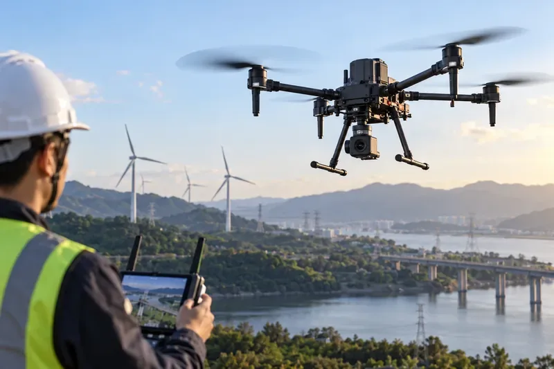
Close-range obstacle sensing, thermal imaging, zoom cameras, LiDAR, and repeatable waypoint flight can reduce pilot workload around bridges, towers, facades, substations, and wind turbines. Autonomous positioning is especially valuable when the mission requires the same inspection path every month.
Surveying and mapping
The most useful autonomy may be less dramatic: consistent line spacing, terrain following, camera triggering, RTK-assisted positioning, and repeatable coverage. Here, data quality and georeferencing often matter more than aggressive obstacle avoidance.
Public safety
Rapid launch, thermal sensing, object detection, high-quality live video, and reliable communications can support situational awareness. The operator still needs clear procedures for airspace, privacy, command authority, and failover.
Remote or dock-based operations
This is where hardware integration becomes most demanding. The aircraft must land reliably, charge or exchange energy, maintain communications, survive weather, run health checks, and recover safely from faults. A drone that flies well under direct pilot control is not automatically ready for unattended remote operations.
Technical autonomy does not equal legal autonomy
This is the limitation buyers often underestimate. In the United States, the FAA's Part 107 page updated July 6, 2026 still states that small commercial drones generally must remain within visual line of sight unless an applicable waiver or other authorization is used. The FAA has been working toward routine beyond-visual-line-of-sight operations, but operators should not assume that a long-range radio, 5G modem, dock, or autonomous route planner by itself grants permission to use it that way. See the FAA Part 107 overview.
The FAA's UTM field-test material likewise explains that testing for future routine BVLOS operations remains subject to existing rules until the applicable BVLOS framework is implemented. In August 2026, the FAA also announced Phase 2 of its BEYOND program to expand testing and integration of advanced operations. For operators, the practical message is simple: evaluate aircraft capability and regulatory authority separately.
Edge compute, sensor quality, model deployment workflow, data governance, fallback behavior
TOPS or processor name without software evidence
The bigger breakthrough is integration
The commercial drone industry is not moving forward because of one miracle battery, one LiDAR sensor, or one AI chip. It is advancing because these components increasingly work as a coordinated stack.
For a construction mapper, the winning system may be a stable aircraft with long endurance, RTK positioning, and a reliable camera. For a utility inspector, multimodal obstacle sensing and a thermal or zoom payload may matter more. For a remote-operation program, communications, charging, health monitoring, and regulatory approval can dominate the decision. And for an autonomous inspection product, efficient onboard AI compute may finally make advanced perception practical without depending on a constant cloud connection.
That is the anatomy worth evaluating: not the drone as a flying camera, but the entire loop from sensing to estimation, perception, decision, control, communications, and recovery.