Home
» Technology
»
Building the Sky Highway: Infrastructure Challenges in Aerial Freight Logistics
Building the Sky Highway: Infrastructure Challenges in Aerial Freight Logistics
As of September 2026, the most important change in aerial freight is not a single new aircraft. It is the steady shift from isolated demonstrations toward network operations. On August 27, 2026, the Federal Aviation Administration announced Phase 2 of its BEYOND program, expanding work on advanced drone integration. Earlier in 2026, the FAA also completed or advanced environmental reviews for several high-volume package-delivery proposals, while Europe continued implementing U-space and EASA published a June 2026 revision of its unmanned-aircraft rules that incorporates the latest SORA 2.5 material.
These developments do not mean that a nationwide “sky highway” is already complete. They do show where the hard work is moving: from proving that an aircraft can carry a parcel to proving that an entire logistics system can operate safely, predictably, repeatedly, and at useful scale. The relevant question for planners is no longer simply, “Can this drone fly the route?” It is, “Can the infrastructure support the route every day without creating unacceptable safety, service, cost, or community problems?”
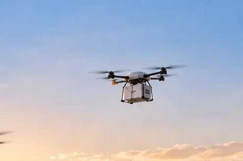
The phrase “sky highway” can sound like a fixed lane painted in the air. In practice, aerial freight infrastructure is a combination of physical facilities, digital services, operating rules, energy systems, communications, weather information, and contingency procedures. Some networks will use small package-delivery drones flying below traditional aviation traffic. Others may use larger vertical-takeoff aircraft or remotely piloted cargo aircraft linking industrial sites, airports, ports, hospitals, or regional distribution centers.
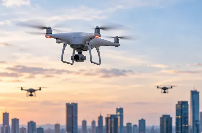
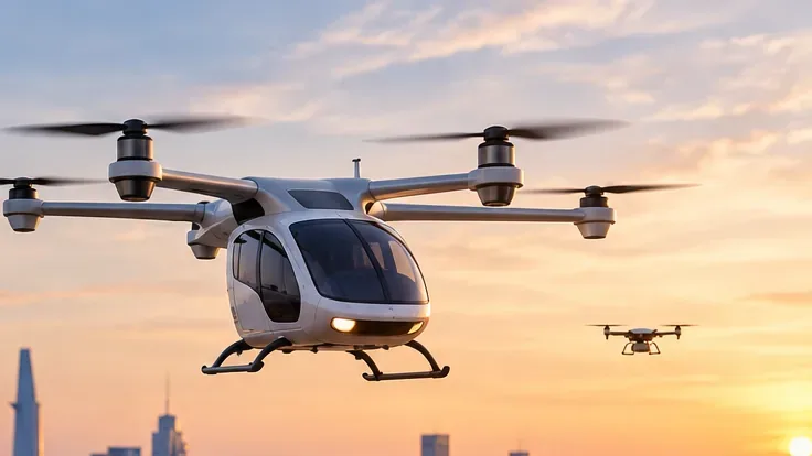
Those categories should not be treated as interchangeable. A small electric drone launched from a retail distribution site may need a compact “nest,” automated loading equipment, battery charging, and access to low-altitude UAS traffic services. A heavier cargo VTOL aircraft may need infrastructure closer to a heliport or vertiport, with stronger pavement, larger safety areas, more substantial electrical capacity, fire protection, maintenance access, and integration with conventional air traffic procedures.
The FAA notes that early advanced-air-mobility operations are expected to use existing airports and heliports with modifications, while purpose-built vertiports and vertistops may follow. Its current Advanced Air Mobility Infrastructure guidance also makes an important limitation clear: current vertiport guidance does not automatically solve every autonomous-cargo or drone-delivery use case.
How to judge whether the infrastructure is actually working
A successful aerial-freight network should not be judged by a spectacular demonstration flight. The better test is whether the system produces repeatable service under realistic operating conditions. A useful scorecard combines safety, reliability, throughput, resilience, community impact, and economics.
Expansion repeatedly creates local opposition or requires shrinking the usable service window
Economic value
Cost per successful delivery, cost per kilogram moved, fleet utilization, avoided road time
More aircraft increase capital cost without increasing completed deliveries
There is no universal pass/fail number for most of these measures. Payload, route length, local weather, population density, regulatory category, energy price, and service-level requirements all change what “good” looks like. The practical action is to define thresholds before scaling a route, then use operational data to decide whether to add aircraft, add infrastructure, or redesign the network.
Challenge 1: Airspace management must scale beyond human-by-human coordination
High-frequency freight operations cannot depend on a controller or operator manually resolving every drone-to-drone interaction. That is the core reason unmanned aircraft system traffic management, or UTM, matters. The FAA describes UTM as a collaborative ecosystem that supports functions such as flight planning, authorization, surveillance, and conflict management, especially for beyond-visual-line-of-sight operations. The agency has also begun issuing Letters of Acceptance to certain UTM service providers supporting strategic deconfliction in approved operations. See the FAA’s UTM overview.
Europe has taken a different but related regulatory route through U-space. In designated U-space airspace, EASA identifies mandatory services including flight authorization and geo-awareness, with additional requirements for information sharing and coordination with crewed aviation. The current framework is described in EASA’s U-space material.
For planners, the quality test is not whether the digital map looks sophisticated. It is whether flight intent, constraints, priority operations, temporary restrictions, and contingencies remain synchronized when traffic density rises. If strategic conflicts, last-minute cancellations, or manual coordination grow faster than flight volume, the airspace architecture is not scaling.
When to change approach: If a proposed dense network requires increasingly large buffers or repeated segregation from other users, a lower-density corridor, different operating hours, additional UTM services, or a different network topology may produce better real-world capacity.
Challenge 2: BVLOS is a regulatory and infrastructure problem, not just a radio-range problem
Beyond visual line of sight is essential for economically meaningful freight routes, but it requires more than a long-range command link. It raises questions about aircraft separation, detect-and-avoid capability, communications, surveillance, operational authorization, record keeping, and responsibility when services fail.
In the United States, the FAA proposed a broad BVLOS rule in August 2025, but the agency’s July 2026 Part 107 summary still states that ordinary small-UAS operations generally must remain within visual line of sight. Advanced operations therefore continue to depend on the applicable approvals, waivers, exemptions, certifications, or other pathways. The FAA’s current status can be checked through its BVLOS rulemaking page and Advanced Operations guidance.
NASA’s ongoing UTM-BVLOS work is valuable because it tests the supporting system, not just the aircraft. NASA describes operators sharing flight plans, detecting hazards, and maintaining situational awareness in shared low-altitude airspace. Its current program is summarized in NASA’s UTM BVLOS project.
Quality test: A BVLOS lane is mature only when normal operations and degraded operations are both understood. Measure how the system behaves when positioning degrades, cellular coverage weakens, a landing site closes, another aircraft enters the area, or weather crosses an operating limit.
Challenge 3: Ground nodes can become the true capacity bottleneck
It is easy to focus on aircraft speed and overlook the minutes spent on the ground. Freight throughput can be constrained by package loading, verification, battery exchange or charging, inspection, maintenance, pad availability, and the sequence in which aircraft arrive and depart.
For small drones, the node may be a distribution-center launch area, retail-site nest, hospital pad, or automated pickup point. For larger aircraft, the node may need vertiport-like design features, protected approach/departure areas, parking, fire-safety planning, passenger-or-cargo separation, and connection to road logistics.
The FAA’s current vertiport work illustrates how many physical variables remain under active study. In June 2026, DOT and FAA broke ground on the V-PAR research facility in Oklahoma City, which will include a vertiport, hangar, and control-center building and will support research into wake separation, downwash and outwash, radio-frequency interference, and vertiport operations. The announcement is available from the FAA.
Quality test: Track the complete cycle from aircraft arrival to ready-for-departure status. If pad occupancy, loading, or charging dominates cycle time, buying more aircraft will not solve the throughput problem. The better investment may be another pad, parallel loading, higher-capacity electrical service, battery management, or a redesigned dispatch schedule.
Challenge 4: Energy infrastructure has to support the peak, not just the average
Electric propulsion can simplify some operating tasks, but it moves a large part of the infrastructure burden into power availability. A site that can charge one aircraft overnight may not support a fleet that returns in waves during the afternoon peak. Power-system planning therefore has to consider simultaneous demand, battery temperature, charging dwell time, local grid limits, redundancy, backup power, and maintenance access.
The correct architecture depends heavily on the aircraft. Some systems may use direct fast charging. Others may use battery swapping, distributed chargers, or scheduled charging between demand peaks. Larger electric VTOL aircraft may create power requirements that are much closer to industrial loads than to ordinary building loads.
When to change approach: If charging queues regularly delay dispatches, do not assume a larger fleet is the answer. Compare additional grid capacity, storage, battery swapping, a second operating base, and revised scheduling. The best choice is the one that improves completed-delivery throughput rather than headline charging power.
Challenge 5: Low-altitude weather and communications are unusually local
Low-altitude freight aircraft operate near buildings, terrain, trees, towers, and other sources of turbulence, blockage, and multipath radio effects. NASA’s UTM research has specifically identified localized wind, reduced line of sight, communications challenges, and limited emergency-landing locations as urban operating issues.
That makes citywide weather from a distant airport insufficient for some routes. A practical network may need localized observations, route-specific weather models, multiple communications paths, and clear rules for what happens when a data source becomes unavailable.
Quality test: Compare forecast conditions with actual route outcomes. If the same street canyon, waterfront segment, rooftop approach, or rural coverage gap repeatedly causes aborts or link degradation, treat it as an infrastructure defect rather than random operational noise.
Challenge 6: Cybersecurity becomes part of flight safety
An aerial-freight network may depend on positioning, cloud services, UTM providers, command-and-control networks, automated loading systems, identity services, maintenance data, and customer logistics platforms. That connectivity increases efficiency, but it also creates dependencies that must be secured and monitored.
NIST has highlighted how increasing connectivity and automation change cybersecurity and AI risks for uncrewed systems, especially in safety-critical applications such as transportation and delivery. Its 2024 publication, Cybersecurity and AI Risk Management for Uncrewed Systems, points to established risk-management frameworks rather than a single aviation-specific cybersecurity recipe.
Quality test: Ask what the network does when a service is unavailable or untrusted. A resilient design should have defined degraded modes, authenticated data paths, logging, recovery procedures, and clear authority to suspend operations when information integrity is uncertain.
Challenge 7: Community acceptance can limit capacity before technology does
Aerial freight creates external effects on the ground: noise, visual presence, operating-hour concerns, privacy perceptions, land-use conflicts, and safety questions. Those issues become more important as flight frequency increases.
FAA environmental-review records from 2026 show why scale matters. Some package-delivery proposals evaluated operations of up to 1,000 flights per operating day from individual centers, while other networks proposed hundreds of daily flights from multiple nest locations. Those are project-specific proposed operating levels, not universal capacity benchmarks. They demonstrate why noise analysis, operating hours, public involvement, and site selection must be treated as infrastructure questions. The FAA publishes these records on its drone environmental review page.
When to change approach: If a route is technically efficient but requires operating hours, altitudes, or site locations that create persistent community conflict, redesigning the network may be more durable than trying to optimize the aircraft alone.
Where aerial freight is most likely to justify the infrastructure
Aerial freight does not need to replace trucks to be valuable. Its strongest early cases are likely to be routes where time, geography, or access matter more than bulk capacity: medical supplies, urgent spare parts, remote communities, offshore or industrial facilities, high-value components, and selected last-mile delivery corridors.
For heavy, low-value, non-urgent freight, ground transport can remain difficult to beat. The same is true where poor weather, complex airspace, short delivery windows, or community restrictions keep aircraft utilization low. A hybrid network can therefore be more practical than an all-air network: trucks handle consolidated trunk movement, while aerial systems serve the segments where speed or access creates measurable value.
A practical build sequence for a scalable network
Prove one lane. Measure completion rate, weather loss, turnaround time, communications reliability, contingency behavior, and cost per successful delivery.
Prove the node. Increase traffic until charging, loading, maintenance, or pad occupancy becomes the bottleneck. Fix the bottleneck before adding aircraft.
Prove shared airspace. Add overlapping routes and verify that UTM, detect-and-avoid, and coordination processes handle normal and abnormal traffic without disproportionate manual work.
Prove resilience. Test communications loss, power disruption, weather deterioration, unavailable landing sites, and service-provider outages.
Prove community fit. Measure noise, public feedback, operating-hour constraints, and land-use compatibility before committing to a dense network.
Scale only where the metrics hold. Expansion should preserve or improve safety and service quality. If performance degrades sharply with volume, redesign the network before expanding farther.
What remains uncertain
The direction of travel is clear, but several important questions are still open. There is not yet one globally uniform UTM architecture. The economics of dense, autonomous freight networks will vary by region and cargo type. Community tolerance at very high flight frequencies is not fully known. Heavy autonomous cargo aircraft will face different certification and infrastructure requirements than small delivery drones. Energy architecture may also change as batteries, charging systems, aircraft designs, and utility connections evolve.
International harmonization remains important because fragmented traffic-management systems can increase complexity and cost. ICAO continues to publish work toward common UTM boundaries and global coordination through its UTM guidance. In the United States, the Department of Transportation’s 2025 Advanced Air Mobility Comprehensive Plan similarly frames infrastructure, policy, research, and local planning as parts of a multi-year transformation rather than a single deployment event.
The standard should be reliable logistics, not impressive aviation
The infrastructure challenge in aerial freight is ultimately a systems-engineering problem. Aircraft performance matters, but the network succeeds only when the airspace, ground nodes, energy supply, communications, weather services, cybersecurity, regulation, and community interface work together.
A good “sky highway” should therefore be judged the same way a mature logistics network is judged: Can it deliver safely? Can customers predict when it will work? Can it recover from failures? Can capacity grow without service quality collapsing? And does the economics remain sensible after all infrastructure and operating constraints are included?
If the answer is yes on one carefully measured corridor, the next step is expansion. If the answer deteriorates as volume rises, the correct move is not to force the network to scale. It is to identify the limiting layer—airspace, ground capacity, power, communications, weather, regulation, or community fit—and redesign that layer first.